Thursday, July 18, 2013

A Shasta Lily and Hundreds of Blackberries! Nature's Trail Magic.

Near McCloud Resevoir - Castle Crags State Park
mile 1476-1506
After staying at a wonderful campground a few miles towards McCloud Lake, I am now at Castle Crags State Park (July 15).  I've read about this park in Sunset magazine and have always wanted to stay.  It's quite beautiful.  Outside of McCloud, the owners of the small park we stayed out were the most gracious couple.  They drove Chief and I around their inherited 450 acre ranch, which they have turned into a Fly Fishing RV/campground.  It has 3 ponds which are stocked for fishermen and only 29 campsites spread out among the beautiful valley with Mt. Shasta looming over you.  Mr. Friday (Bob) was intent that I see a Shasta Lily, as they only bloom during a small window of perhaps 7-10 days and we were right in that time period.  Bob and MayLawn drove us all around in their little electric cart to find the lily.  Chief had been talking about this flower for a day or two, as the aroma is undescribable and you can smell it above anything else when walking through the forest.  Sure enough, we found a small patch of 5 - 6 lily's.  They were quite aromatic.
Such nice people.  I hope we can go back to this little gem of a place, in the middle of nowhere.

Leaving Chief at trailhead early this morning, I set off for my short drive to Castle Crags State Park, where the PCT meanders through.  Stopped in Dunsmuir early at the coffee shop to have breakfast.  Apparently, just missed Roger Dodger who was also in Dunsmuir.  Would have really liked to see him again.  Drove a bit south, as the trail now does some wierd south-west bendy crap.  It's the big bend WEST, towards Etna. Got to Castella (store and Post office...that's it!) and picked up Chief's box.  Had some new shoes sent here by REI (shoe number 4).  The store is the hangout as it is also the resupply and Trail Angel for the area.  Nice couple who run this little store, The Ameritas Market.  They have the biggest selection of IPA's I have evers seen!  Even their own brand!

Will leave here tomorrow and head north towards Etna (him walking the 100 miles and me driving, far less!) Very excited to be back in that neck of the woods.  There is also the plus that there is a Blue Grass Festival this weekend in Etna!  Chief is going to take a zero day and we will definitely enjoy our last couple of days together, listening to music, eating and drinking.
Beautiful flowers at campground
Fly Fishing pond, doubles as Bodie's swimhole! Note- cabin in backround!

Our spot (Friday's Fly Fishing Spot)
Found the trail!  Love this scavenger hunt I'm on.


nice
Volunteer Trail workers


bit overgrown on the PCT

FOUND HIM!

Feeding the skinny man

Appetizers

Great IPA's

Bodie in flight

Thank god for this truck.  Crazy FS road


Left some trail magic
Nature's trail magic

Thru's picking up resupply at Ameritas Market

hmmm?  where's Chief's?

The Beer Selection

Ameritas Market, Castella, CA

True Definition of HIKER TRASH

Bodie so excited to see Beads again

OH the trash they have in the Lending Library!!!!

new shoes
Castle Cragg's State Park


Sunday, July 14, 2013

I'm NO ANISH, but I did do 52miles in 2 days!


mile 1476, near Lake McCloud Resevoir

If you think you're something, well think again, along comes Anish!  She passed me at our party at Burney Falls.  Obvisouly, she doesn't have time to eat or drink, as she is doing a 42 mile per day pace!  Trying to break the speed record for the PCT.  Good for her.  I can barely move after a 30 mile day.
Check her out...and she's so young and cute.

https://www.facebook.com/AnishHikes

Left Burney early after a crazy, fun night with the whole gang.  This is the group that is up and at em' before 5:30.  Well, I left at 7am and they were not stirring (little too much partying).  My goal was to have Maureen pick me up on a FS road, Grizzly Road.  Seemed ok on map.  WRONG.  Got a text from her after she made the attempt to go 8 miles on this so called road.  She ended up going in Reverse for almost 2 miles when she could go no further, only 2.3 miles from PCT junction. Found the FS fire guys and made it out with a bit of help.  Oh well.  Her text sounded desperate but she was ok and we realized that pick-up was not going to work!  Decided that she could do a pick up at the Lake McCloud Damn.  Another FS road, but definitely a better one, according to Data Book.  That meant 2 big days for me to walk.

First day did a long hard day (29 miles) as water was a problem along with no good camping spots. I walked through a thick forest with no available water.  It's like you get in a mind set that you're in the Sierra's and the water should be plentiful, but the forest was too thick to get to it safely. Passed 2 springs that maps said were there, but couldn't find them.  I really didn't want to sleep on the trail with no water.  Ended up finding an old logging deck with a creek (headwaters of the MooseHead creek) nearby. Soaked my aching feet in the ice cold creek.  Heaven.  Set up my tent.  Ate my Salmon with mashed potatoes and went to sleep with my loud neighbor, Mr. Bear.  He continued ripping through his log looking for grubs through the night making lots of noise. Didn't want to turn on my headlamp.  Sometimes not knowing is the best way to deal with a loud Bear. Hoping that I triple wrapped the salmon trash really well.

After going through lava fields with an almost desert like landscape, the trail now became a thick deep  forest.  I really miss the high Sierra's!! Really, really love those Eastern Sierra's.

Second day hiked 24 miles to get to Maureen.  Chatted with a volunteer PCTA trail crew.  Doing beautiful work with a really nice camp.  Propane showers, tents, mules, kitchen, water filters.  This is an annual event and people from all over the country come to this Northern Calif. area to help with the PCTA trail maintenance.  Trail boss is John Lyons.  His daughter, just so happens to live in Lompoc, and is part of our local, Los Padres Backcountry Horsemen.  John was also in our unit, but moved to Etna.  Super nice guy.  Offered me a fruit bowl and a coke - mid morning snack for PCTA hiker! Actually invited me to stay for dinner, but knew I could get caught in another Vortex and Maureen and Bodie would be somewhere on the trail.
Trail was up, down, up, down, more up and down through more thick forest.  Saw a Big Buck (Mikal...I mean BIG!), Bear scat, another bear. Enough of the bear sightings.  Found Bodie and Maureen coming up through the forest!  Was great.

Bears - 3
Rattlesnakes - 9
Will be happy if neither increases at this point.

Chief


Dense forest walking for about 55 miles

Going over that way...Mt. Shasta in the background

PCTA Trail Crew kitchen

more Kitchen..check out tree


Saturday, July 13, 2013

The Community, Magic and Culture of the PCT...from Chief's wife's eyes....


Burney Falls State Park – July 11 - 13
Mile 1423

My road trip journey continues as I travel the PCT section of N. California.  This section comprises 409 walking miles, which for me translate into about 150 driving miles.  I love it.  I spend so little time in the truck driving, mostly hanging out at great campsites and little mtn. towns.  I continue to pick up thru hikers and get them back on the trail after their resupply pick-ups. 

This morning, as I was leaving Hat Creek campground, I picked up Texas (who I haven’t seen since my resupply at Walker Pass with Dan’s cheesecake cupcakes! Texas remembers them fondly as he ate 6 of them!)  and the couple from Maine, Gumby and DoubleTake. Bodie loved them.  He was their early morning wake-up call as he bounced into their tent at 7am.  Usually the hikers have all left before 6am for the day, but they took a late morning as they were waiting for the Post Office to open to get their resupply boxes.  He had a great time with Gumby in her tent.  The hikers that have had to leave dogs behind for 5 months, LOVE Bodie.  They really miss their dogs. 

The little camp store was the “hiker trash” hangout last night.  6 hikers came in late in the afternoon and drank beer, ate ice cream and taco’s all afternoon in front 
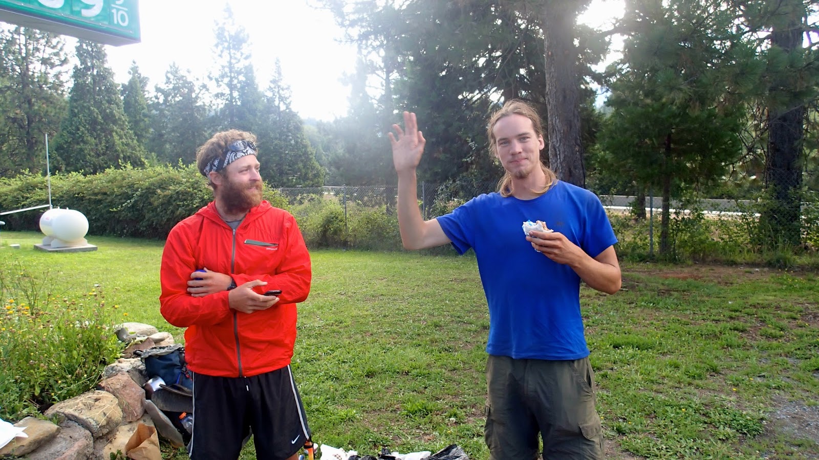
of the store. Was so happy to see Kattywompus, IceMan, Maverick and Lodgepole (father/son team).  They all made me promise that Chief would take a zero-day today at Burney Falls so they could catch up with him.  Apparently, he made Kattywompus a promise at Sonora Pass that he would walk “old man speed” so that they would meet again.  I’m hoping he will consider the zero day?  He is only taking 3 more zero’s before Mt. Hood (Timberline Lodge), when I arrive from Portland on Aug. 19.  I know that Ashland is one of the zero’s.  He desperately needs a haircut.  Sorry Geralyn! I’m sure whatever the outcome is, it will all grow back for you to give him a proper haircut in October.

I’ve made a big Dutch Oven dinner for this evening and hope to feed at least 4 that I think are with Chief.  Leaving Burney Falls, the PCT takes the BIG BEND and heads west into the Shasta-Trinity National Forest.  I’m not sure if I’ll be able to follow along as well through this section (limited access).  Castle Crags State Park may be my last camping spot before I head home on the I-5.  Ick.  I may decide to continue North-west and meet Chief at Etna.  Etna is a very cool little town between the Shasta-Trinity and the Klamath National Forest.  My parents retired there for 10 years before moving back to our area when my father became ill.  It has all the charm of a little, mtn, community (brewery included).  Kevin won’t even talk to me about leaving.  He loves this little traveling vortex!  It will be back to hiker boxes to be picked up and no more nice bed and cushion to sit on every other night! 

Several hundred people leave the Mexican border around springtime to begin the adventure of a lifetime – a thru-hike, a continuous journey along the entire length of the PCT.  
Along the way, thru’s experience the serenity and fullness of life at nature’s cadence (which I really enjoy!) and meet residents of nearby communities (trail towns) who sometimes perform acts of profound generosity (called Trail Magic).  Kevin has told me so many stories of trail magic that I can’t even begin to go into them all, but they are out there and always a surprise. Trail magic is tangible evidence that the trail brings people together in unique ways and has a culture all of its own.  Usually the term, “trail Magic” is used to describe the kindness of strangers, who sometimes come to be known as “trail angels.”  Trail Magic may be as basic as a cold drink at a road crossing, or a ride into town from a trailhead.  It may be a home cooked meal, a clean pair of socks, or a soft bed to sleep on for a night.  It definitely infuses a hiker with gratitude and faith in the human spirit. 


Another aspect of PCT life is the adoption of trail names.  As you are aware, Chief got his name from a friend of ours, Paul. aka BeeMan,. He is a section hiker as he continues to work as a teacher in our hometown.  He takes many of his long breaks to complete various sections.  He has been an inspiration for Chief. We were so hopeful that they could finish together, but I’m not sure about that. Trail names are generally given to you by other hikers.  No one calls each other by their given names, and I still get quite a chuckle from hikers when they hear me call Chief, Kevin!  They just laugh.  He’s only Chief to them. 

To communicate up and down the trail, hikers use log books that are left at trail junctions or in local towns.  They serve as the trail grapevine and can be very helpful for unknown water cache sites. 

I know that I’ve touched on some of these “qualities” of the PCT,  in some of my previous updates, but I hope you get the idea.  It’s really quite magical.


Chief's wife.

I've attached some pics of our hiker party at Space 45 in Burney Falls State Park Campground.  It was quite a magical evening, one I'll never forget.
Space 45!  Party spot

Pancakes for breakfast.  What no granola bar?


Chief, Birdman and Cowboy 

Cowgirl, Midnight Choc, Maverick


some of the gang


Our very cool camping neighbor, Chuck..who was so interested in meeting the hikers


silly stuff

Maverick insisting he can eat all of these dogs?

The cooler that kept giving

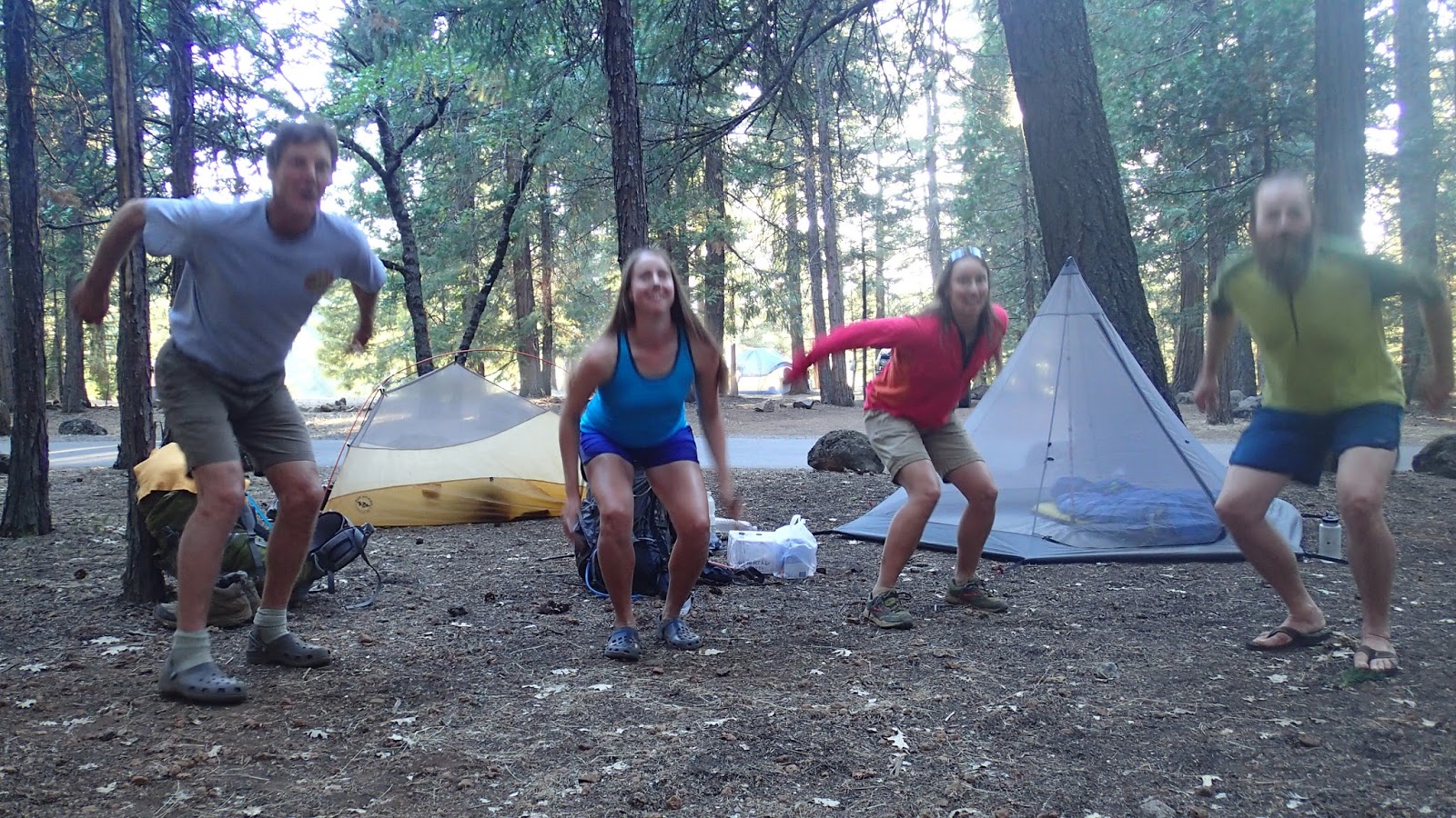
my very poor attempt at a Jump Pic!  sorry Erin, didn't do so well


IceMan and Kattywompus repacking after their resupply arrived 


Will they find us?
Resupply box
LodgePole (Maverick's dad)

The Hat Creek Rim, Oh my Goodness!


By Chief
Mile 1423

Hat Creek Rim is about 50 miles from Old Station to Burney Falls State Park.  Basically, it exists because of a volcanic valley with lava cliffs.  Trail starts out from Old Station, within 3 miles you get to the Subway cave, which is a lava tube.  Sometimes hikers will spend the afternoon in the subway cave, which is at least 20 degrees cooler than the ambient temperature.  From the cave you climb 500 ft. to a lava cliff, which you follow for basically 30 miles, with no water.  There are signs along the trail that specifically say, “Don’t drink surface water in the Hat Creek Rim.”  Not that there was any water.
Think Mojave desert when you walk this stretch.  Fires have burned much of the vegetation along this stretch hence there is no shade. Our strategy was to see the subway cave and then walk to the lookout (7 miles from Old Station), shade up to the late afternoon hours.  Left at 4pm with Cowgirl and Midnight Choc.  We then walked 13.5 miles to a water cache, which we were hopeful was going to be there.  We were prepared to continue on the entire 30 miles without a water supply (carrying lots of water).  The trail tread was strewn with lava rocks.  It meandered along the rim of a cliff.  There was no trail maintenance and I can’t reason why it meandered when it just could have been straight? and it was a hot afternoon.  About 2 miles from the cache, I wasn’t sure I was going to make it without a resupply.  Arrived at the mile marker of the water cache at 8:30.  There it was.  40-1 gallon containers of spring water from the Hat Creek basin.  At that moment, I felt like the next best thing to HEAVEN. Thank God for Trail Angels. I filled up with 4 liters of water.  Walked 200 yards until I found a flat spot.  Rolled out my bedroll and began to prepare my dinner.  Best dinner I have had in weeks. Tortilla’s, hummus, chili cheese wheat thins, beef jerky and snickers for dessert. 

It’s difficult to describe this feeling of euphoria from the discovery of water and a flat spot to sleep and a simple dinner.

That was only HALF of the Hat Creek Rim! I was pleased to see Cowgirl and Midnight Choc. to arrive about 40 minutes later.  Slept in this morning.  Started walking at around 6am for about 12 miles. Again through exposed lava fields to the next water – creeklet.  After that it was another 11.5 miles to Burney.  Long stretch.

Caught up with Beads, Lint, Cowboy and BirdMan.  Stumbled across, not 1, but 2 Trail Magic Caches’.  The first was some beer with a nice note.  The second magic had a table, 2 ice chests (with ice), soda, beer, and a box of assorted chips and crackerjacks, which I enjoyed.  Even got a mermaid tattoo from my crackerjack box!  8 more miles continued with a mix of forest and lava until we arrived at the Burney Falls State Park. 

I had made it past the dreaded Hat Creek Rim.  Had a large soft serve ice cream at the General Store in the Park.

Chief


Hat Rim Creek Magic - the Water Cache..Thank you Most wonderful Trail Angel 
The start of the Hat Rim Creek Trail

30 miles of this little crappy, meandering trail that can't seem to go in a straight line

Have to watch your every step or you trip on Lava Rock

Next Trail Magic.  They left a camera to take pics of yourselves.  Bead doing her duty

Hmmm?  not PBR this time!

PAUL C.  aka Bee Man.  Here's the tat you and I are going to get when I get home in October!  Get ready

Lint and Beads enjoying the lawn chairs and a beer

Yes.  less miles to Canada

almost to Burney