Sierra Passes and Rivers – mile 744 to mile 907

Shane’s roommate and lifelong friend, Ari, decided to join me for the majority of this section, which is most of the John Muir Trail. He arrived from sea level to Lone Pine, where Maureen dropped us off at Horseshoe Meadows to start from Cottonwood Pass to meet up with the PCT.
As we were leaving, we met Billy Goat...the Icon and Legend of the PCT. What an amazing man. He lives on the PCT until winter and then hikes in the southern states, typically Florida. Billy Goat is a wise old soul who anointed Ari with the trail name, Sea Level.
The Passes. So this segment has 7 named passes. Forester, Glen, Mather, Pinochet,
Muir, Selden, and Silver, 5 of which are technically challenging and all about 12,000
ft or higher. Forester is the tallest and additionally, the highest point on the PCT
standing at 13,180 ft.
Additionally in this segment you have the potential for treacherous river crossing due to snowmelt and strong currents. Everyone is nervous and apprehensive about these passes and river fords. A lot of energy is spent on these issues. We are constantly asking other PCT hikers that may have heard rumor about the in’s and out’s the next 200 mile segment. “What about the ice-‐chute on Forester?” “How about the potholing?” “River crossings?”
Calories. How many calories can I fit in my Bear Box? How many resupplies will I need to get from Kennedy Meadows to Mammoth? Do I travel fast to get more food at the difficult resupplies? Strategies all revolve around food. Conversation on the trail revolves around food. Food takes over our world. This was the longest resupply on the PCT – mile 702 to 907. No resupply on the trail for 205 miles. You have to make decisions on calories and food. And always with the limitations of that darn Bear Box.
Play time. We had a Pool Party in the late afternoon at Grouse Meadow. The middle fork of the Kings River meanders through a high sierra meadow, very similar to Yosemite, although on a smaller scale. The current runs at about 2mph. We floated down the river, ran upstream and jumped in again. There were nine, skinny, hungry, thru-‐hikers as playful as elementary kids at a pool party.
First day we walked 16 miles leaving Cottonwood Pass. Sea Level needed a relatively easy day to get adjusted to the elevation changes. No big passes nor river crossings, just a day to get used to his pack, shoes, and my walking speed.
Muir Pass. Well, it was quite a day. Hard to really describe this event. June 10, 2013. We needed to crest Muir Pass before noon otherwise the post-‐holing on both sides of the pass would be so difficult that we would expend 10 times the energy per mile. The problem was that the approach to Muir Pass was a long and steady climb. We started early, although it was still a climb to do before 11am. The rest of our “play-‐mates” has started ahead of us. Muir Pass is actually an East-‐West pass, so as we turned the corner to get a view of the pass, we see big, black cumulous storm clouds building over the pass. That is when my throat dropped in my stomach. I knew we needed to push the pace to get up and over the pass before the Storm hit. The problem is that we were now in snow and rock and couldn’t find the trail.

Shane’s roommate and lifelong friend, Ari, decided to join me for the majority of this section, which is most of the John Muir Trail. He arrived from sea level to Lone Pine, where Maureen dropped us off at Horseshoe Meadows to start from Cottonwood Pass to meet up with the PCT.
As we were leaving, we met Billy Goat...the Icon and Legend of the PCT. What an amazing man. He lives on the PCT until winter and then hikes in the southern states, typically Florida. Billy Goat is a wise old soul who anointed Ari with the trail name, Sea Level.
 |
| Chief and Stagecoach |
Additionally in this segment you have the potential for treacherous river crossing due to snowmelt and strong currents. Everyone is nervous and apprehensive about these passes and river fords. A lot of energy is spent on these issues. We are constantly asking other PCT hikers that may have heard rumor about the in’s and out’s the next 200 mile segment. “What about the ice-‐chute on Forester?” “How about the potholing?” “River crossings?”
Calories. How many calories can I fit in my Bear Box? How many resupplies will I need to get from Kennedy Meadows to Mammoth? Do I travel fast to get more food at the difficult resupplies? Strategies all revolve around food. Conversation on the trail revolves around food. Food takes over our world. This was the longest resupply on the PCT – mile 702 to 907. No resupply on the trail for 205 miles. You have to make decisions on calories and food. And always with the limitations of that darn Bear Box.
Play time. We had a Pool Party in the late afternoon at Grouse Meadow. The middle fork of the Kings River meanders through a high sierra meadow, very similar to Yosemite, although on a smaller scale. The current runs at about 2mph. We floated down the river, ran upstream and jumped in again. There were nine, skinny, hungry, thru-‐hikers as playful as elementary kids at a pool party.
First day we walked 16 miles leaving Cottonwood Pass. Sea Level needed a relatively easy day to get adjusted to the elevation changes. No big passes nor river crossings, just a day to get used to his pack, shoes, and my walking speed.
Muir Pass. Well, it was quite a day. Hard to really describe this event. June 10, 2013. We needed to crest Muir Pass before noon otherwise the post-‐holing on both sides of the pass would be so difficult that we would expend 10 times the energy per mile. The problem was that the approach to Muir Pass was a long and steady climb. We started early, although it was still a climb to do before 11am. The rest of our “play-‐mates” has started ahead of us. Muir Pass is actually an East-‐West pass, so as we turned the corner to get a view of the pass, we see big, black cumulous storm clouds building over the pass. That is when my throat dropped in my stomach. I knew we needed to push the pace to get up and over the pass before the Storm hit. The problem is that we were now in snow and rock and couldn’t find the trail.
There were snow bridges that we needed to be extremely careful not to fall through.
We needed to walk through snow fields that were steep and slippery and we needed
to walk carefully that we wouldn’t fall into a rock pile or river and we were trying to
navigate in a hurry to find the trail. I made it to about 300 yards from the crest of
the pass, when grapple starting falling, where Muir Hut (a granite stone hut that the
Sierra Club built in 1930 for a safe refuge from storms) was finally visible. My the
time I reached Muir Hut, it was a full snow storm. Sea Level was still behind me. I
had been continually urging him to continue to push to crest the summit. I couldn’t
see him coming. All I could see was a horizontal flow of snow. I stepped into the hut
to a cheering of 7 PCT hikers. “Yay Chief! You made it!” “Where’s SEA LEVEL?” “ It’s
his Mother’s birthday. He has to make it. I don’t want anything to happen to him
today!” They were encouraging and then I saw the top of his hat. Baxter ran out to
get the heroic photo op of Sea Level cresting the pass, but he approached from the
backside of the hut! The photo will remain in our memories. It was a great moment.
9 happy refugees from an early Sierra summer storm together in Muir Hut. Much to
our shigrin, Muir Hut LEAKS A LOT! We put our raingear on to avoid the drips. We
pulled out our stoves and made Mocha’s with our Starbucks and Hot cocoa mix.Best Mocha I ever had. Then the jokes started and we all acted like we were never
scared. After about an hour, we settled down and Wild Cat read from her kindle the
“Ghosts of Muir Pass!” A story from one of the PCT readers. So as she is reading, one
of the possibilities of how the Ghost dies was a lighting strike. We immediately hear
a loud thunder clap. We all closed our mouths, opened our eyes and exclaimed, “Did
we really hear that?”
The storm slowed down after about 4 hours. 7 hikers decided to brave the wind and the cold to try and get down off the pass. Ari and I decided to spend the night in the Muir Hut, although it was damp and still dripping, it was the warmest and coziest night I have ever spent in the Sierra’s. We woke up to a cold blue bird sky with sparkly new snow and we were able to descend the pass on a wonderful, Sierra day. Quite a memory I will always cherish. I was extremely proud of Ari. He reached deep down and didn’t panic and did what he had to do.
The 7 that went ahead were worried about us and we were worried about them. When Ari and I walked into VVR (Vermillion Valley Resort) for our resupply, there is an outside bar. There we had a happy reunion -‐ 2 different strategies that both had good outcomes. We cheered and hugged. It was great. Beers flowed and stories were told.
I am so thankful for friends and family. Greg and Tom who delivered my resupply at VVR (the “Indians!”), Maureen who has continued to make my food, prepare my resupplies, and to all of you that are following my walk. Thanks again to the Phelps who are getting ready for my next resupply, thanks to those Trail Magic cookies! It really all makes a huge difference. And a big thanks to ARI! You were amazing. I am so proud of you. I hope the magic of the PCT has given you some insight into your life.
 |
| Birthday note to Michelle! |
The storm slowed down after about 4 hours. 7 hikers decided to brave the wind and the cold to try and get down off the pass. Ari and I decided to spend the night in the Muir Hut, although it was damp and still dripping, it was the warmest and coziest night I have ever spent in the Sierra’s. We woke up to a cold blue bird sky with sparkly new snow and we were able to descend the pass on a wonderful, Sierra day. Quite a memory I will always cherish. I was extremely proud of Ari. He reached deep down and didn’t panic and did what he had to do.
The 7 that went ahead were worried about us and we were worried about them. When Ari and I walked into VVR (Vermillion Valley Resort) for our resupply, there is an outside bar. There we had a happy reunion -‐ 2 different strategies that both had good outcomes. We cheered and hugged. It was great. Beers flowed and stories were told.
 |
| Muir Hut, after the storm |
I am so thankful for friends and family. Greg and Tom who delivered my resupply at VVR (the “Indians!”), Maureen who has continued to make my food, prepare my resupplies, and to all of you that are following my walk. Thanks again to the Phelps who are getting ready for my next resupply, thanks to those Trail Magic cookies! It really all makes a huge difference. And a big thanks to ARI! You were amazing. I am so proud of you. I hope the magic of the PCT has given you some insight into your life.
 |
| Ari (SeaLevel) on Forester Pass ledge of death |
 |
| SeaLevel |
And now for a bit of philosophy. Something I don’t generally share but this trail has a way of doing things to you.
As you share your stories with fellow PCT hikers you eventually talk about the motivation behind walking the PCT? There is the youngest group just graduated from high school and don’t want to move further with their life until they have an adventure. There’s the “20 something’s” that have graduated from college and don’t want the choices and responsibilities yet. They are trying to decide what is important to them? The midlife’s who want to make some changes in their lives, either with their careers or their personal life choices or both. The latter years, like me, who are struggling to get one more adventure in their life!
I have been thinking a lot about what my motivation is. I think that some of my motivation was to reflect on my life and my career, my choices and questions the why’s of some of the decision’s I’ve made. Is my compass in the same direction that I can live with at this time in my life? I feel like my moral compass is in the right direction, but I think I question should I have taken different decisions or directions. Now I have time to reflect on the choices I have made and make possible changes if needed? I have always had the weight of “responsibility” on my shoulders. The day of Muir Pass, I not only had the responsibility of my survival, but also of Ari. I realized that that responsibility is part of my make up and although it weighs me down, it also empowers me. It is who I am.
Chief
 |
| It is who I am |


 |
| Home Sweet Home |
 |
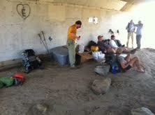
| Lunch time |

Pictures to follow...from Ari!